Cornerstone

BHC Chamber • December 30, 2020

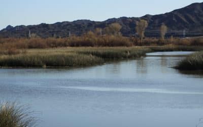
From the Mojave villages to Fort Mohave and Hardyville, Laughlin and Bullhead City, the Colorado River was the cornerstone. Originally the river served as an artery of commerce, and the communities on its banks thrived. With completion of Davis Dam, new communities were built on electrical generation, recreation, and warm sunny winters prospered. 

With passage of the Reclamation Project Act in 1939, a new era dawned in the desert southwest. To harness the power of the lower Colorado River, on April 26, 1941, the Bullhead Dam project was authorized. It would later be renamed Davis Dam, an honorarium for Arthur Powell Davis, the director of the Bureau of Reclamation from 1914 to 1923. In comparison to the mighty Hoover Dam, it was a relatively small project and as a result, when the contract for construction of the dam and powerhouse was awarded in June of 1942 the estimated time for completion was forty-eight months. This included construction of Davis Camp on the Arizona side of the river. The mess hall and dormitories were deemed crucial to the project as the dam was being built in a relatively remote part of Arizona with Kingman and Needles both being more than thirty miles away. Access roads to Kingman and Needles were also a part of the project.  

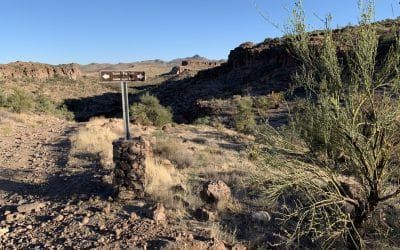
As an historic footnote, shortly before WWII options were being evaluated to bypass the Route 66 bottleneck that was Sitgreaves Pass in the Black Mountains. In 1949 a preliminary survey was completed for a Route 66 realignment. If built this storied highway would have roughly followed modern state highway 68 from the U.S. 93 junction, U.S. 466 in the 1940s, to the Colorado River. It would then cut west across the desert to connect with U.S. 466 near the Nevada/California state line. 

In 1952 the highway was instead rerouted to follow the 1914 National Old Trails Road Valley Cutoff west from Kingman through Yucca. In the late 1950s the earlier Route 66 survey was dusted off and updated for a proposal that called for I40 to connect Kingman with I15 at Bishop, California. This would have resulted in a bypass of Yucca, Needles, Essex, Amboy, and Ludlow.   

In the spring of 1943, the Davis Dam project was suspended as it was not deemed a vital war asset. Workers, equipment and building materials were transferred to Kingman for use in the construction of the Kingman Army Airfield. Auxiliary fields were also constructed in Yucca, near Red Lake north of Kingman, and at Site Six, now the island in Lake Havasu City. 

On September 2, 1945, the Bureau of Reclamation initiated revaluation of projects in the desert southwest including Davis Dam and Bridge Canyon Dam. In April 1946, Utah Construction was awarded the primary contract for construction of the dam. A primary change in the project was in regard to Davis Camp. Instead of a rough construction camp, this was now to be a small town for workers, most of whom were veterans, as well as their families. The original plan called for construction of one hundred homes, a recreation center with swimming pool, general merchandise and grocery store, several churches, various service facilities for storage and repair of equipment, post office and service station.  

With the completion of Davis Dam in 1953, Davis Camp faded from prominence. In the spring of 1959, the Bureau of Reclamation initiated the sale, demolition, and removal of buildings. Many of the buildings, however, were given a second lease on life as homes, store fronts or storage facilities in Bullhead, Topock, Needles and Kingman. By 1970, less than thirty-five original buildings remained.

In this year, a new chapter in Davis Camp commenced. As many employees began purchasing homes in the area, the Bureau of Reclamation solicited National Park Service and Arizona Department of Public Safety employees to rent the remaining homes. Then in 1982 the Bureau of Reclamation changed the status of Davis Camp, suspended all rental leases, and deemed the property as surplus. As a result, most of the remaining houses were sold and moved, or razed. The Catholic Church building remained and was later used to house the Colorado River Historical Society Museum. 

In 1982, a joint initiative between Mohave County, National Park Service, Bureau of Reclamation, National Park Service, and the Arizona State Parks Board launched a project to transform the site regional river side park. Six small garages, original buildings, were retained to serve as the park’s maintenance yard and a former house was remodeled to serve as the ranger station. In 1988, two of the original 1946 houses were renovated and offered as rentals for park guests. 

Over the years the park evolved to meet the needs of the growing community of Bullhead City. A combination restroom and shower building were added along with expanded parking areas, a concession stand, and in 2010, and amphitheater. 

Bullhead City is a modern progressive community. It is also a community with a rich and colorful history that has a common thread, the waters of the Colorado River.  

A desert landscape with a tree in the foreground and a blue sky with clouds in the background.
By Jim Hinckley July 13, 2022
A few months of high temperatures is the price we pay for living in the desert oasis of Bullhead City along the Colorado River. But it is a dry heat, just like the oven. And our fall, winter and spring temperatures are far more enjoyable than Duluth, Billings, or Fargo. On a more serious note, yes, it is hot come July and August. But with a bit of perspective, and a history lesson, summer becomes much more tolerable. Case in point, a few days ago it was 102 degress in Denver, Colorado, the “Mile High City.” And the humidity was nearly 50%, a dramatic difference from the 11% humidity in Bullhead City. And of course air conditioning in our homes, offices and cars make even the hottest day bearable. But how did people survive the desert heat before air conditioning. According to the accounts of early explorers, the Mohave that called the river valley home for centuries spent a lot of time swimming in the river during the months of summer. Hardy pioneers that settled Hardyville, built Fort Mohave, and developed mining camps in the rugged Black Mountains used time honored desert construction methods. The used adobe and stone, built […]
A sign in the middle of a desert with mountains in the background.
By Jim Hinckley June 15, 2022
In the literal sense of the words Bullhead City, Arizona on the Colorado River is not an ideal place to look for greener pastures. After all, it is located on the edge of the vast Mojave Desert. However, if you consider the term in the context of opportunity, Bullhead City is ideally suited for people in search of greener pastures. Measurable snowfall is such a rarity that it is considered an historical event. Bullhead City is centrally located. And it has a progressive business climate. The COVID 19 pandemic sparked a seismic societal shift. Remote work became a viable option for many people. Business owners were forced to evaluate alternative options based on tax incentives and long term sustainability. A series of studies reveal that in general business owners cite several main reasons for relocation. These include work force related issues, proximity to new and growing markets, the deisre to curtail operating costs, a need to upgrade facilities, and quality of life issues for emplyoees. Quality of life is a difficult item to quantity. Essentially factors include educational opportunities and quality, diversity of recreational opportunities, and health care access. Climate, crime rates, and infrastructure related issues such as traffic and […]
A view of a desert landscape from a rocky cliff with mountains in the background.
By Jim Hinckley May 10, 2022
In the modern era Bullhead City, Arizona is known for many things. It is a recreational desert oasis on the Colorado River. It is a top rated location for remote workers. It is ideally suited for retirement. It has a friendly business climate that is ideally suited for the entrepreneur with vision. And, of course, we are known for hot summers and very mild winters. Even though Bullhead City is not located along a major interstate transportation corridor, river boats, railroads and highways have played an important role in the areas development. And transportation will also be playing an important role in its future. Key to Arizona’s early development was steamboats on the Colorado River and river ports that connected to a network of trails such as the Mohave Prescott Road. Hardyville and Mohave City near present day Bullhead City were crucial riverpoints in northwest Arizona. As an historic footnote, both towns also served as the county seat. In the early 1880s construction of the Atlantic & Pacific Railroad and the bridging of the Colorado River marked the beginning of the end for riverboat traffic. It also fueled development of river valley agriculture and mining on the west slope of […]
A large body of water surrounded by tall grass and mountains.
By Jim Hinckley April 9, 2022
Bullhead City, Arizona on the banks of the Colorao River is often referenced as a desert oasis. And rightly so. This dynamic, vibrant mini city that is firmly rooted in a colorful history is fast becoming a destination for people lookinig for a new place to call home. Counted among the many gems that make Bullhead City special is Havasu National Wildlife Refuge, a desert oasis in the literal sense of the world. It was established with an Executive Order issued by President Franklin D. Roosevelt in 1941 to preserve migratory bird habitat on the middle Colorado River. These riparian areas were being increasingly threatened with construction of dams on the Colorado River. These included Parker Dam completed in 1938, Boulder Dam, now Hoover Dam, dedicated on September 30, 1935 and Davis Dam completed in 1951. The refuge consists of 37,515 acres along the river in Arizona and California. Even though it only protects thrity miles of river it encompasses nearly 300 miles of shoreline from near Needles, California and Topock, Arizona to Lake Havasu City. This is one of the last remaining natural riparian areas on the river and it includes the majestic twenty mile long Topock Gorge, and […]
A sign for jackass junction is hanging on a wooden wall.
By Jim Hinckley March 9, 2022
Bullhead City is ideally suited for the outdoor enthusiast. We are at the heart of a fishing and boating paradise. There are miles of fascinating hiking or moutain bike trails such as the old railbed for the historic Mohave Mill Town Railroad between Oatman and the Colorado River. And if you are a fan of off road and back country trips, there are a coutless number of scenic old mining roads that range from moderate to challenging. A great loop drive that presents the illusion of a backcountry adventure begins at Bullhead City Community Park, a delightful desert oasis with beach and boat launch. Continue south on highway 95 through Fort Mohave to Boundary Cone Road, county road 153. To set the mood for your odyssey, be sure to stop and read the monument at the junction. As you drive east toward the foothills of the rugged Black Mountains and the easily identified Elephants Tooth rock formation, suburbia quickly gives way to rugged desert wilderness with stunning views of the Colorado River Valley. The next highway junction is with iconic Route 66. Continue into Oatman, an old mining town transformed into the romanticised image of a village on the western […]
A gas pump with a sign that says approved on it.
By Jim Hinckley February 4, 2022
Ghost towns. Just the mere mention of these words conjures visions of dusty streets, blowing tumbleweeds, and weathered old buildings adorned with faded signs. As with many things in life the reality is often quite different from the dream. Some towns , such as Oatman, stretch the very definition of ghost town. This old mining town has been transformed into a tourists Mecca. As a result the line between historic tangible link to the western frontier and the romanticized perception of that time are blurred. Goffs located west of Needles, California on state highway 66 is less than a wide spot in the road. But there was a time when this was a bustling railroad center with an economy fueled by traffic on the Arrowhead Highway, National Old Trails Road, and later, Route 66. As what remains of Goffs is mostly windswept ruins and sun faded relics the first time visitor is surprised to discover the Mojave Desert Heritage and Cultural Association that is housed in the renovated historic 1914 schoolhouse. The diverse array of exhibits inside as well as outside at this museum complex are on par with what you would find in a major metropolitan area. Nelson, Nevada, […]
A view of a desert landscape with mountains in the background.
By Jim Hinckley January 10, 2022
Bullhead City on the Colorado River is a progressive, modern community with an eye fixed on the future. It is centrally located to major metropolitan areas and a diverse array of outdoor recreational sites. This as well as a mild winter climate and a business friendly climate make it an ideal location to open or relocate a business, to retire, and to raise a family. The world is taking notice. The COVID 19 pandemic dramatically transformed employment and escalated a shift to companies hiring remote workers. A recent report noted that 62 % of employed Americans worked remotely for at least several weeks in either 2020 or 2021. In January 2021, InMyArea released a study of the best communities for remote workers. Bullhead City, Arizona rated number six in the top communities recommended. And it was the only community in the southwest to make the list. In 2018 and in 2019, Bullhead was listed as one of the most affordable cities in the state of Arizona. This was based a the formula that constitutes a city’s composite index comprised of six components; housing, groceries, utilities, transportation, health care and miscellaneous goods and services. More recently a study found that Bullhead […]
A row of motorcycles parked in front of a building.
By Jim Hinckley December 4, 2021
The months of winter in Bullhead City, Arizona and the Colorado River Valley are ideally suited for adventure and exploration. And with family arriving for the Christmas holiday from the snow country of the north and east, a shared desert adventure will make memories that last a lifetime. The quirky, fun, almost ghost town of Oatman is nestled along iconic Route 66 against the picturesque Black Mountains just fifteen miles from Bullhead City. Dating to the dawn of the 20th century Oatman, and the nearby communities of Goldroad and Old Trails purportedly had a population of more than 5,000 people during the teens. Today the burros roam wild in the streets. And what visit to a frontier era western mining town could be considered complete without a shoot out in the street? The colorful and fun reenactments are performed daily. The old Durlin Hotel, now the Oatman Hotel, is the oldest and tallest adobe building in Mohave County. There is an urban legend that Clark Gable and Carol Lombard stayed at the hotel on their return trip to California after their March 1939 wedding in Kingman. There is also a legend about miners leaving money at the hotel bar to […]
A desert landscape with a tree in the foreground and a blue sky with clouds in the background.
By Jim Hinckley November 7, 2021
Union Pass marks the summit after the long climb from the Colorado River Valley on highway 68. For the observant remnants of the areas rich mining history are seen from the highway. Some of the earliest mining activity in Mohave County took place on the western slopes of the Black Mountains in the area of Union Pass. The first recorded gold discoveries in the Oatman and Union Pass Mining Districts date to 1863 and a mine established by John Moss. Hidden amongst the rocks, the brush, and shadowy canyons in Union Pass is decades of Arizona history. In 1851, Captain Lorenzo Sitgreaves and a contingent of topographers, naturalists, artists, and military personnel left the Zuni Pueblo in western New Mexico. Their assignment was to explore and map the Zuni and Colorado Rivers, evaluate their navigability, and determine the feasibility of a wagon road across what is now northern Arizona. The expedition was led along a Native American trade route across what is northern Arizona. They followed a route that bypassed the depths of Canyon Diablo, north of the San Francisco Peaks, and then around the south side of Bill Williams Mountain. Much of the route traveled would later be followed […]
Blank
By Richard Scully October 11, 2021
The new season is a great reason to make and keep resolutions. Whether it’s eating right or cleaning out the garage, here are some tips for making and keeping resolutions.
More Posts